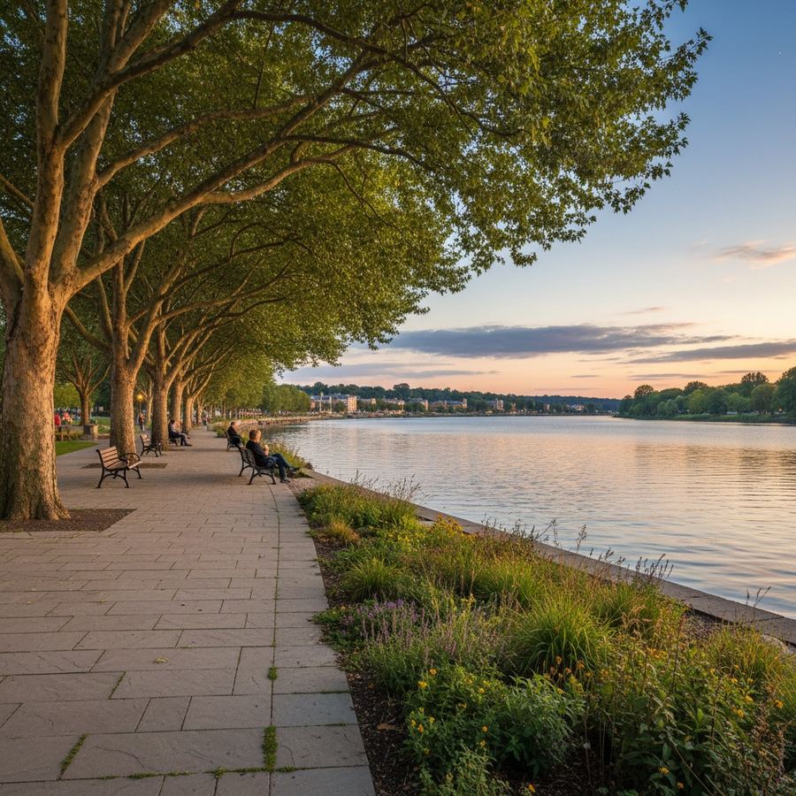
Municipal waterfront improvement plans arrive wrapped in language designed to sound visionary. Words like "activate," "reimagine," and "vibrant destination" appear on nearly every page. The renderings show families strolling along sunlit promenades and cafes spilling out onto boardwalks. The documents are long, the ambitions are large, and for most residents the experience of reading one is deeply frustrating.
That frustration is worth pushing through. These plans determine what happens to some of the most valuable public land in any community. Understanding what a plan actually says, and what it carefully avoids saying, is one of the most useful things a resident can do before the public comment period closes.
Start With the Goals, Not the Renderings
Every waterfront plan has a section near the beginning that outlines goals or guiding principles. This is the most important section and the one most people skip. Read it carefully, because these goals are the standard against which everything else should be measured.
Look for specificity. "Enhance public access" could mean almost anything. "Provide continuous public waterfront access from Bridge Street to the marina, with no gaps greater than 100 meters" is something you can hold someone accountable for. The more vague the goals, the more latitude designers and politicians have to claim success regardless of what gets built.
Learn to Read the Phasing
Nearly every waterfront plan is divided into phases. Phase 1 is what will be built with currently available funding. Phases 2 through 4 are aspirational, meaning they will happen only if future councils allocate the money, if grant applications succeed, or if a private development partner materializes.
This distinction matters enormously. A plan might promise a connected waterfront trail, but if Phase 1 only builds a 200-meter section near the downtown core and the remaining three kilometers depend on future funding, the connected trail may never happen. Look at Phase 1 closely. That is the plan. Everything else is a hope.
Pay attention to what gets placed in the later phases. If accessibility features, naturalized shorelines, or connections to underserved neighborhoods are all in Phase 3, that tells you something about priorities. The things that get built first reflect what the decision-makers actually value.
Follow the Money
Somewhere in the plan there will be cost estimates. These numbers are almost always preliminary and almost always low. But they still reveal important information.
Compare the estimated costs to the municipality's actual capital budget. A plan proposing $40 million in improvements in a town with a $5 million annual capital budget is not realistic without external funding. Check whether the plan identifies specific funding sources or relies on phrases like "potential grant opportunities."
Also look at operating costs. Building a waterfront park is the easy part. Maintaining it, staffing it, keeping the washrooms open, and replacing damaged infrastructure are ongoing costs that municipalities frequently underestimate in the planning phase.

Decode the Land Use Language
Waterfront plans often include changes to land use designations. If the plan proposes "mixed-use" development, that typically means residential towers or commercial buildings with ground-floor retail. If it mentions "public-private partnerships," that usually means a developer will build something profitable in exchange for contributing a public amenity like a walkway or small park.
These arrangements come with trade-offs. A residential tower generates tax revenue and may include a public path at its base, but it also privatizes views and changes the shoreline permanently. The plan should be explicit about what the public gets, and "a vibrant mixed-use destination" is not an answer. Square meters of public space, guaranteed access easements, and maintenance obligations written into development agreements are answers.
Check the Environmental Commitments
Most modern waterfront plans include a section on environmental stewardship, habitat restoration, or shoreline naturalization. Read this section with attention to verbs. "Will restore" is different from "may explore opportunities to restore." "The design includes" is different from "future phases could incorporate."
Look for specific environmental commitments: how many linear meters of shoreline will be naturalized, what species of vegetation will be planted, whether stormwater will be managed on-site or directed into the lake, whether fish habitat requirements have been addressed. If the environmental section reads like a list of admirable intentions rather than a set of concrete actions, it is unlikely to survive the budgeting process intact.
Understanding terms like bioswale, riparian buffer, and green infrastructure makes this section much easier to evaluate. If you are not familiar with the terminology, the glossary on this site covers the most common terms in plain language.
Look at Who Was Consulted
Every waterfront plan includes a section describing the public engagement process. This section will list open houses, surveys, stakeholder meetings, and sometimes online comment periods. What matters is not the number of engagement events but who actually participated and whether their input changed anything.
Look for evidence that the plan was shaped by consultation, not just presented during it. If the engagement summary says "residents expressed concern about parking" and the plan still eliminates parking without explanation, the engagement was performative. If the plan says "based on resident feedback, the design was revised to include additional seating areas and shade structures," that is a plan that took consultation seriously.
Also check who the stakeholders were. If the consultation involved business owners, developers, and tourism boards but not residents of nearby neighborhoods, the plan is likely optimized for economic development rather than community livability.
Ask the Right Questions at Public Meetings
If you attend a public meeting about a waterfront plan, the most useful questions are specific. Instead of "will this benefit the community," try these:
What happens if Phase 2 funding does not materialize? Will Phase 1 function on its own, or will it be an incomplete fragment?
What is the guaranteed public access? If private development is involved, where exactly are the public easements, and who maintains them?
What are the annual operating costs, and where is that money coming from? A beautiful waterfront that deteriorates within five years because there is no maintenance budget is worse than a modest waterfront that is well-kept.
How will accessibility be addressed? Not in principle, but specifically: grades, surfaces, seating intervals, barrier-free access to the water's edge.
What environmental studies were completed, and what did they find? If the plan proposes building on or near a shoreline, there should be environmental assessments. Ask whether the recommendations from those assessments were incorporated into the design.
The Rendering Problem
Renderings sell plans. The trees are always mature, the weather is always perfect, and the spaces are populated with happy people. This is marketing, not dishonesty, but it is worth recognizing.
When you look at a rendering, mentally strip away the people and mature landscaping. What is left? A wide sidewalk? A parking lot? A row of commercial buildings with a narrow path squeezed along the water? The underlying design is what will be built.
Compare the renderings to the site plans, which show actual dimensions. A promenade that looks spacious in a rendering may be only four meters wide in the site plan. Dimensions matter more than aesthetics at the planning stage.
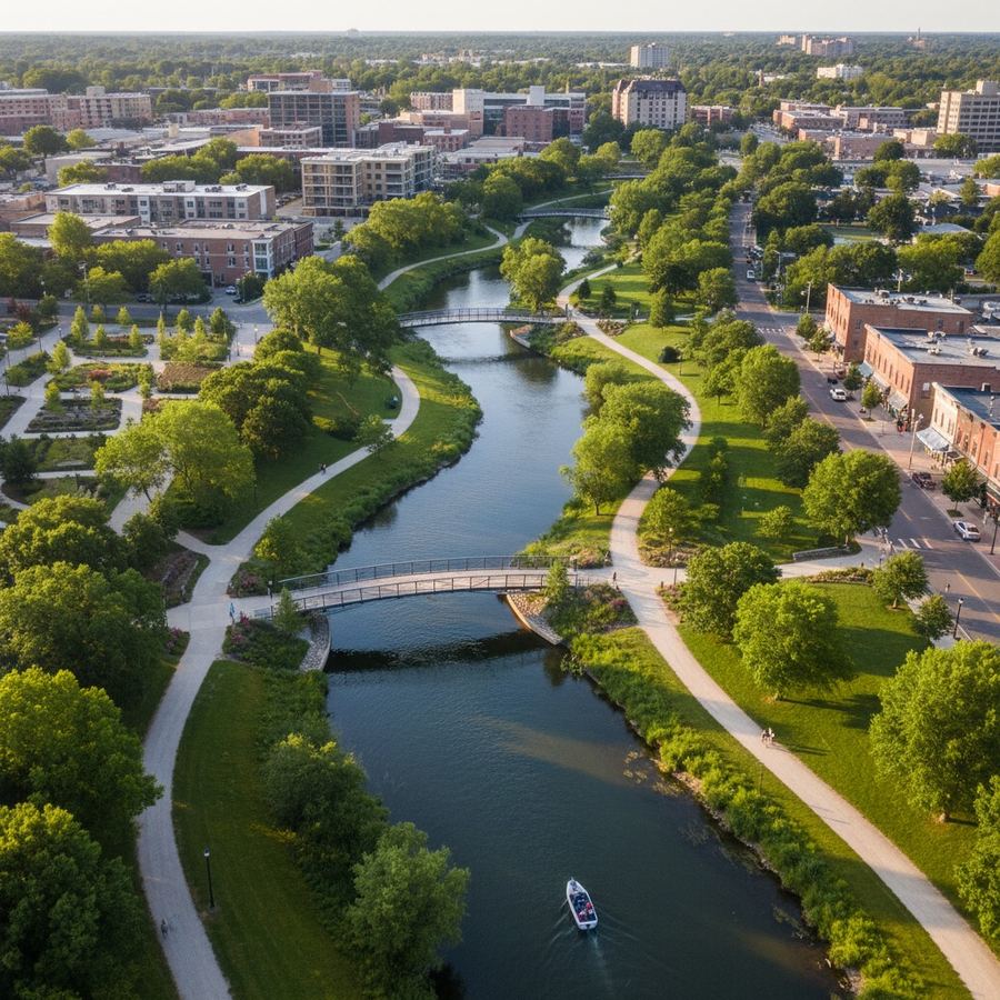
Why This Matters
Waterfront land is finite. A community typically gets one chance to shape its waterfront for a generation. Most of the important information is in the plan, buried under optimistic language and beautiful images. Reading a waterfront plan carefully is one of the most effective things a resident can do to ensure that waterfront access serves the public interest.
For related guidance, the checklist for evaluating trail systems applies many of the same principles, and the questions to ask about revitalization projects offers a broader framework for assessing public investment.