There is a familiar pattern in American waterfront development. A city rediscovers its river or harbor edge. Officials announce a plan for public access. Renderings appear showing wide promenades, decorative railings, and happy families on smooth concrete paths at the water's edge. A few years later, the project is built. The shoreline is hardened with riprap or seawalls. The vegetation buffer is gone. The water view is lovely, but the ecology that made the place interesting has been replaced by an engineered surface that functions like a parking lot with better scenery.
This is the default approach in most places, and it is worth questioning. Waterfront access is important. But the way we build it matters enormously, both for the people who use it and for the natural systems that depend on the shoreline.
Why Shoreline Edges Are So Sensitive
The area where land meets water is one of the most biologically productive zones in any landscape. Riparian buffers filter stormwater runoff before it reaches the water. Root systems stabilize banks and prevent erosion. Overhanging vegetation provides shade that keeps water temperatures within the range many aquatic species need to survive. The U.S. Fish and Wildlife Service has consistently found that riparian zones support a disproportionate share of terrestrial wildlife species relative to their small footprint.
When we strip that zone down to hardscape, we lose all of those functions at once. The result is warmer water, more sediment, faster erosion downstream, and habitat loss for species that depend on the transition between land and water. These are not abstract environmental costs. They affect water quality, flood risk, and the long-term stability of the very infrastructure we just built.
What Better Access Looks Like
The good news is that waterfront access and ecological integrity are not mutually exclusive. Dozens of projects across the country demonstrate that you can bring people to the water without destroying the shoreline. The key principles are straightforward.
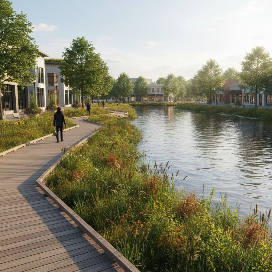
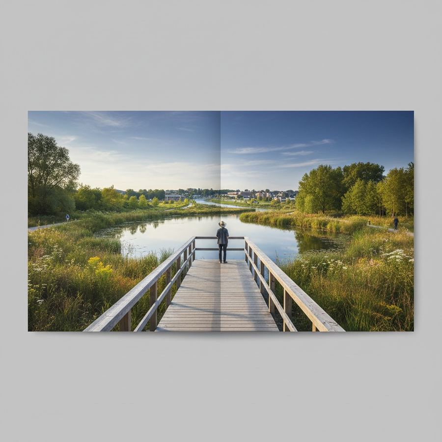
First, elevate the path. Boardwalks and elevated walkways allow people to move through sensitive areas without compacting soil or trampling vegetation. The Anacostia Riverwalk Trail in Washington, D.C. uses this approach in several segments, routing users over restored wetlands on elevated structures that provide excellent views while protecting the habitat below. The construction cost is higher than a paved path, but the long-term maintenance cost is often lower because the shoreline remains stable.
Second, set back from the edge. Not every foot of waterfront needs to be accessible at the waterline. A path set back 30 or 50 feet from the water, with periodic overlooks or access points to the shore, gives people the experience of being near water without requiring continuous disturbance along the entire edge. The Chattahoochee RiverLands project in metro Atlanta is designed around this principle, treating the river corridor as a connected system rather than a continuous boardwalk.
Third, use the vegetation as a feature, not an obstacle. Native plantings along a waterfront path are not just ecological infrastructure. They provide shade, reduce wind exposure, screen noise, and create visual variety that makes a walk more pleasant. Olmsted understood this 150 years ago. The Emerald Necklace in Boston routes people along water edges through a continuous landscape of native and naturalized plantings rather than hardscaped promenades.
The Promenade Problem
Wide, flat, fully paved waterfronts have their place. In dense urban cores where the shoreline was industrialized a century ago and the original ecology is long gone, a built promenade makes sense. The Chicago Lakefront Trail works in its context because the shoreline it occupies was already entirely engineered. No one is asking to restore the natural edge of a landfill.
The problem arises when that same design vocabulary gets applied to rivers, creeks, and lakeshores where the natural edge is still intact or could be restored. A small city with a healthy riparian corridor does not need the same treatment as downtown Chicago. But the promenade template is popular because it photographs well, it reads clearly in planning documents, and contractors know how to build it.
This is a design problem, not an engineering problem. It is about choosing the right approach for the specific place rather than applying a standard solution everywhere.
Real Examples Worth Studying
Several projects illustrate what thoughtful waterfront access looks like at different scales.
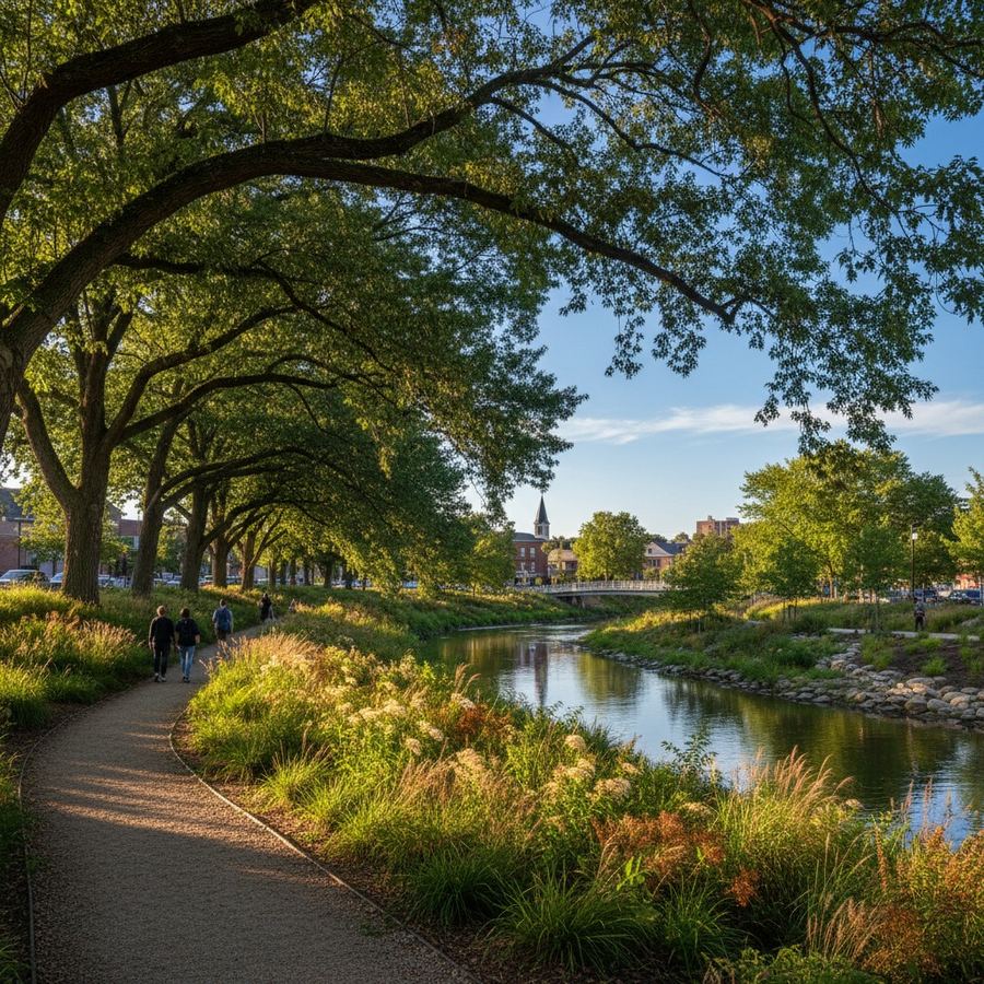
The Buffalo Bayou Park restoration in Houston transformed a channelized, eroding bayou into a functioning riparian corridor with public trails. The design, led by SWA Group, pulled paths back from the water's edge, replanted native species, and allowed the banks to re-establish natural grades. The result handles flooding better than the old engineered channel while giving residents continuous access along the corridor.
In Duluth, Minnesota, the Lakewalk follows the Lake Superior shoreline for several miles. Where it passes through sensitive areas, the path narrows and shifts inland. Where the shore is rocky and stable, it moves closer to the water. This variable approach responds to conditions on the ground rather than imposing a uniform cross-section.
Portland, Oregon's Eastbank Esplanade includes a 1,200-foot floating walkway section. This is an expensive solution, but it demonstrates the principle: you can give people direct water access without permanently altering the shoreline. The floating section moves with water levels and does not require the bank modifications that a fixed structure would demand.
What Communities Should Ask
When a waterfront access project is proposed, a few questions can help distinguish a thoughtful design from a reflexive one. What is the current ecological condition of the shoreline? If there is a functioning riparian buffer, is the design preserving it or removing it? How far is the primary path from the water's edge, and does that distance vary based on conditions? Are there points of direct water access, or is the entire edge treated the same way? What happens to stormwater from the path surface? Does the design account for changing water levels, seasonal flooding, or long-term erosion?
These are not radical questions. They are the kind of basic due diligence that any waterfront project should address. The fact that many projects skip them is a reflection of how standardized waterfront design has become, not how complicated the alternatives are.
Access as a Long-Term Relationship
The best waterfront projects treat access as an ongoing relationship between a community and its water edge, not a one-time construction event. This means designing for maintenance, allowing vegetation to mature, accepting that some areas will look rough around the edges for a few years after construction, and planning for the inevitable changes that water systems bring.
It also means thinking about who controls the shoreline and who benefits from access. A waterfront trail that only serves a new residential development is not public infrastructure. A continuous greenway that connects neighborhoods to each other and to the water, with multiple entry points and varying character, is something closer to a genuine public amenity.
The underlying principle is simple. Water edges are valuable because they are where two systems meet. When we flatten that meeting point into a uniform surface, we lose the thing that makes it worth visiting.
Better waterfront access is not about less access. It is about smarter choices about where, how, and at what intensity we bring people to the water. The shoreline will tell you what it can handle, if anyone bothers to ask.
Communities that take this approach seriously often find that the result is not just ecologically better but also more popular. People are drawn to places that feel alive, where birds land on nearby branches and fish are visible in clear water. A concrete promenade next to a degraded shore cannot compete with a well-designed path along a healthy corridor. The ecology is not an obstacle to good access. It is the reason the access is worth building.