Floodplains have an image problem. In public conversation, they tend to be treated as either dangerous no-build zones or ignored entirely until something floods. Neither framing is helpful. A floodplain is not inherently off-limits. It is a piece of landscape that periodically does what it has always done: carry water. The question is not whether to avoid floodplains. It is how to use them intelligently, in ways that respect the water while still allowing communities to function.
This matters because floodplains are not marginal land at the edge of town. In many cities, the floodplain runs through the center of the community. It includes downtown waterfronts, historic neighborhoods, industrial areas, and commercial districts that have been there for a century or more. Telling these places they should never have been built is not useful. Helping them adapt to flood risk in practical, incremental ways is.
What a Floodplain Actually Is
A floodplain is the flat or gently sloping land adjacent to a river, creek, or other waterway that is subject to periodic inundation. When water levels rise beyond the channel's capacity, the floodplain is where the excess water goes. This is not a malfunction. It is what rivers do. Floodplains have been absorbing overflow for as long as rivers have existed, and the soils, vegetation, and topography of floodplains have evolved around that cycle.
The Federal Emergency Management Agency (FEMA) maps floodplains using statistical models based on historical data and hydrological analysis. The most commonly referenced boundary is the 100-year floodplain, which represents the area with a 1 percent chance of flooding in any given year. There is also the 500-year floodplain (0.2 percent annual chance) and various floodway designations that identify the channel and immediate overflow areas where water moves fastest.
These maps are useful but imperfect. They are based on historical rainfall data that may not reflect current precipitation patterns. They do not always account for upstream development that has increased runoff. And the "100-year" label is widely misunderstood. A 1 percent annual chance of flooding means there is a 26 percent chance of at least one flood occurring during a 30-year mortgage. That is not rare. That is a meaningful risk that communities need to plan for.
The Problem With Binary Thinking
The conventional approach to floodplain management often defaults to a binary: build or do not build. Inside the floodplain, strict regulations limit what can be constructed. Outside, development proceeds as if flood risk does not exist. This sharp line creates problems.
It ignores the gradient of risk. Flood risk does not stop at the mapped boundary. Localized drainage issues, undersized culverts, and impervious surface accumulation create flood risk in areas that FEMA maps show as dry. It also sterilizes valuable land unnecessarily. The deep, fast-moving floodway near the channel is fundamentally different from the shallow fringe of the 100-year boundary. Treating them identically misses the opportunity to match land use to actual conditions.
And binary rules create political resistance. When floodplain regulations are perceived as blunt instruments, property owners and officials push back. A nuanced approach that allows appropriate uses in lower-risk areas while protecting critical flood storage tends to be both more effective and more politically durable.
Designing for Water Instead of Against It
The most productive way to think about floodplains is not as places to avoid but as places to design for water. This means accepting that water will arrive, planning for where it will go, and building in ways that tolerate periodic inundation rather than being destroyed by it.
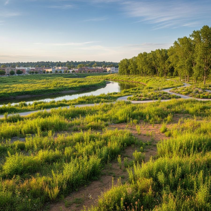
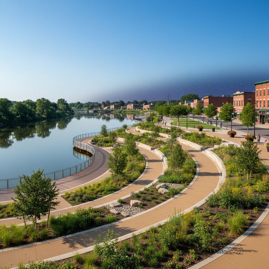
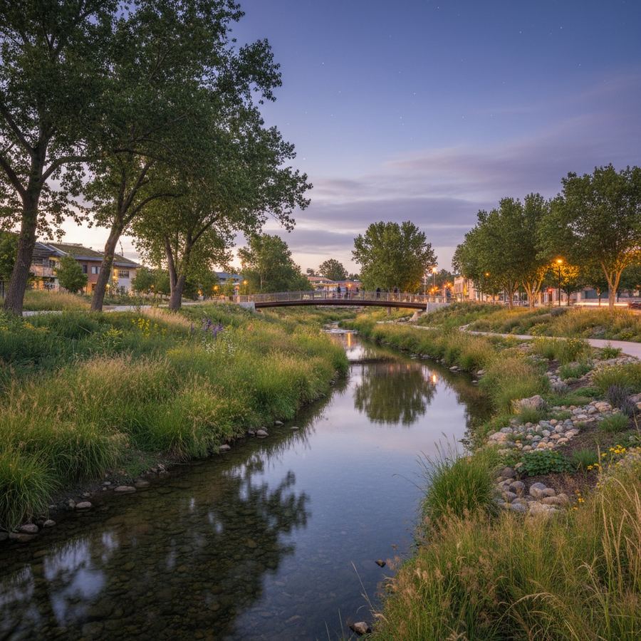
Parks and recreational areas are natural fits for floodplain land. A soccer field that floods twice a year and drains within a day is still a perfectly functional soccer field. A riverside trail that occasionally goes underwater is still a valuable trail 350 days a year. Green space in the floodplain provides flood storage, habitat, recreation, and stormwater management simultaneously. It is one of the most efficient uses of public land in any community.
Buildings can be designed for flood zones too. Elevated structures with parking at ground level tolerate moderate flooding. Wet floodproofing allows water to enter and exit a lower level without structural damage. The key principle is matching the use to the risk. Hospitals and senior housing should not go in the deepest parts of the floodplain. But a brewery with a concrete floor, a boat launch, or a community garden can work perfectly well on land that floods occasionally, as long as the design accounts for it.
What Good Floodplain Communities Look Like
Several communities have demonstrated that smart floodplain management does not mean abandoning valuable land. It means using it differently.
In Cedar Rapids, Iowa, after devastating floods in 2008, the city acquired hundreds of properties in the most flood-prone areas and converted them into a greenway along the Cedar River. But it also invested in flood protection for its downtown, elevated critical infrastructure, and designed new public spaces that tolerate periodic flooding. The result is a city better prepared for floods with a more functional waterfront than it had before.
Charlotte, North Carolina has done similar work, buying out repetitively damaged homes and converting the land into greenways and connected park systems. The Nature Conservancy has documented many such examples where floodplain restoration serves as both a flood risk strategy and a community amenity.
The Role of Upstream Thinking
Floodplain management is often treated as a local land-use question, but flooding is a watershed-scale problem. What happens upstream affects what happens downstream. A new development five miles up the creek that adds 50 acres of impervious surface increases runoff volume and peak flows at every point downstream. A farmer who restores a wetland at the headwaters reduces peak flows for the entire watershed below.
This means that effective floodplain management requires thinking beyond municipal boundaries. Regional stormwater management, watershed-scale planning, and green infrastructure investments in the upper watershed all affect flood risk in the floodplain communities downstream. A city that only manages its own floodplain without considering what is happening upstream is managing a symptom rather than the system.
The EPA's stormwater management guidance emphasizes this watershed perspective. Distributed green infrastructure, such as rain gardens, permeable pavement, and retention basins spread across a watershed, can reduce peak flows more effectively and at lower cost than centralized flood control structures in many cases. The benefit compounds: each upstream site that captures and slows runoff reduces the peak that arrives in the floodplain below.
Living With Water
The Dutch have a phrase for this: "living with water." The Netherlands has shifted over the past two decades from fighting water to accommodating it. The Room for the River program deliberately lowered floodplain barriers, widened channels, and created flood storage areas. The result was better flood protection and better landscapes.
American communities are not the Netherlands, but the principle transfers. The places that manage flood risk most effectively are the ones that accept water as a feature of the landscape rather than treating it solely as a threat. They build parks in floodplains. They design buildings that can get wet. They invest in upstream storage and green infrastructure. They use natural areas as buffers rather than building right up to the creek bank.
This does not mean ignoring risk. It means being honest about what the risk is and responding to it with design rather than denial. The floodplain is not going away. The water is not going to stop coming. The question is whether communities will keep fighting that reality or start working with it. The ones that choose the second path tend to end up with better places to live.